Tour of Jersey, Channel Islands
|
RS Home
|
|
Jersey, together with the Island of Guernsey and
the other smaller islands of Alderney & Sark,
form the Channel Islands, in the English Channel,
just off the coast of France.
The UK and France have fought over the Islands for
centuries. Jersey is now regarded as part of the UK,
although it is a self-governing Parliamentary
Democracy, and is not a part of the European
Union.
The currency in the Channel Islands is the British
Pound, or the Islands own Pound that has the same
valuation as the British Pound. Beer Prices .
Currency
Converter.
Flights take about 1 hour 30 minutes between
Northern UK Airports and Jersey Airport.
Jersey Airport is 5 miles
northwest of the Island Capital of St Helier.
Bus Links . Google Map
For information on Airlines that fly to Jersey,
visit, wiki/Jersey_Airport.
|
|
Jersey is made up
of 12 parishes: Grouville, Saint Brelade,
Saint Clement, Saint Helier, Saint John,
Saint Lawrence, Saint Martin, Saint Mary,
Saint Ouen, Saint Peter, Saint Saviour &
Trinity.
Google
Map
|
|
|
The Parishes to the north only have very
small Villages.
The Island is 9 miles by 5 miles with the
main Resorts and Beaches on the south side. The
northern areas are more rugged.
The main roads run all the way around the
Island, through all the Towns and Villages, B
roads lead out to the Coast.
The Island has a Speed Limit of 40 MPH, and
you drive on the left side.
|
|
St Helier is
the capital of Jersey, in St Aubin's
Bay on the southern side of the Island.
Most of the Hotels are here, or in St
Aubin's across the Bay.
Large
Image by Tobias Scheck
Google
Map
|
|
|
The Town has looks like British with French
and Portuguese touches.
The Town centre has a good variety of shops,
restaurants and cafes. The central Market is a
good place to buy Jersey's own produce, such as
Flowers, Jersey Royal Potatoes, and fresh Fish.
The Market has been here since 1882.
The Harbour and Marina are normally busy
with Ferries, Yachts and small Fishing Boats.
You can also take a Walking Tour around the
historic Harbour led by a guide.
The view above is of Liberation Square,
built in 1995 to celebrate the 50th anniversary
of Jersey being liberated from Nazi
Occupation.
|
|
Elizabeth
Castle is on the tidal Island
L'Islet, in St. Aubin's Bay.
Construction of the Castle began in
1594, completed in the 1600s.
Large
Image by Tobias Scheck
Google
Map/Reviews
|
|
|
The Governor of Jersey, when
the Castle was completed, was Sir Walter
Raleigh. He named the Castle Fort Isabella
Bellissima, meaning the Most Beautiful
Elizabeth, after Queen Elizabeth I.
Access to the Castle is across
a Causeway from St Helier beach at low tide, or
in a Wading Vehicle that can travel through the
water, as long as the weather is not too
rough.
Wiki . Visiting
Information
|
|
Jersey
Museum and Art Gallery in St
Hellier, tells the story of Jersey from
neolithic times to the present day.
Website
. Map/Reviews
|
|
|
Here you can view the Island's finest
treasures, including a priceless Bronze Age
gold torque/neck ring, and Millais' famous
portrait of Lillie Langtry.
The Jersey Museum covers from 250,000 years
back, giving information on key factors and
People that shaped the Island over the
following centuries.
|
|
Maritime
Museum at St Helier's Harbour
covers Jersey's Maritime past. You can
See, Touch, Hear, and even Smell the
exhibits.
Google
Map/Reviews
|
|
|
The Maritime Museum mainly covers Seafaring,
Navigation, and the Elements. The Exhibits
allow you to experience the force of a Gale,
learn about the Tides, and see how to design a
Ship that floats.
More
Information
|
|
Taking a tour of the Island
anti-clockwise 48 miles around.
Saint
Clement is one of the twelve
Parishes in Jersey.
Google
Map
|
|
|
Saint Clement is just east of Saint Helier,
in an area that contains some of the Suburbs of
St Helier.
Samares Manor and Gardens are in St Clement.
These impressive Gardens were created in the
1020s for the shipping magnate, Sir James
Knott.
Here you can visit the Manor House, The
Rural Life and Carriage Museum, Herb Garden,
Herb Garden Cafe, and more.
More Information .
Map Reviews
|
|
Grouville
Parish is just east of Saint
Clement Parish in the southeast of the
island.
Google
Map
|
|
|
In the area is La Hougue Bie,
one of Europe's best preserved Passage Graves.
This site gives an insight into Jersey's
Neolithic community 6,000 years back. Also in
this area is a Command Bunker built during the
German Occupation, and a Memorial in the memory
of Slave-Workers in the Channel Islands during
WWII.
Map/Reviews
Also in the area is the Royal Jersey Golf Club
|
|
Gorey is a
village in the parishes of St. Martin
and Grouville on the east coast of
Jersey. It is one of the three main
harbour's on the Island.
Large
Image by Iain Cameron
|
|
|
As Gorey has the closest Harbour on the
Island to France, it has a history of conflict
dating back to the Iron Age.
After the division of the Duchy of Normandy
in 1204, this Castle of Mont Orgueil was built
to protect the Island against the French.
The Castle also served as residence for
Governors of Jersey until Elizabeth Castle was
completed at Saint Helier in the 1600s.
Wiki . Map
|
|
Heading west along the north of the
Island is the Parish of Trinity with
Jersey Zoo.
Large
Images by Iain Cameron
Map/Reviews
|
|
|
This is where you can find the Royal Jersey
Agricultural and Horticultural Society at the
Royal Jersey Showground, the States Farm, and
Jersey Zoo.
Also in the area is the Pallot Steam, Motor
& General Museum. This Museum was founded
by the late Don Pallot.
Website . Map/Reviews
|
|
Next traveling west is the Parish of
St John, then the Parish of St Mary. On
the north coast of the Parish of St
Mary are the Greve de Lecq
Barracks.
|
|
|
You can explore The Barracks whenever the
doors are open. Here you can find information
on Jersey's north coast, Greve de Lecq's
history, scenes from 19th century military
life, and the story of the defence of the
island. Also, a collection of horse-drawn
vehicles are on display and local Artists
exhibit their work. The Barracks also house the
National Trust for Jersey shop.
More
Information. Map
Another attraction in the area is Le Moulin de
Quetivel, a Water Mill where there has been
Mills since the early1300s. The Mill has been
restored to working order by the Trust and
grinds its own Flour to this day. The Mill also
has a display of Neolithic Quern Stones found
in Jersey, an Exhibition showing the history of
Milling, and a Video Room where you can watch a
Film about Quetivel. Visitor Reviews
. Map
|
|
St Ouen is
in the north west of the Island, the
largest Parish by surface area.
Large
Images by Andy Hawkins
|
|
|
St Ouen's Bay, as seen above, is a popular
place for Water Sports.
Also in the area, on Mile Road, is the
Channel Islands Military Museum. The collection
has been built up over the years to allowing
visitors to see items that are still in the
same condition as when they were when last used
over 60 years back.
With the Museum set in one of Hitler's
former Atlantic Wall defences, it gives
visitors a true feeling of life during WWII in
the 1940s. Map/Reviews
More
Information on the Channel Islands Military
Museum
Les Mielles Golf and
Country Club.
|
|
Saint Brelade
Parish is on the south west of
the Island, with some of the most
popular Bays in Jersey.
Large
Images by Amanda Slater
|
|
|
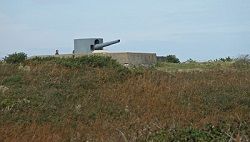
In the area is the Noirmont
Command Bunker, a German Naval Command Bunker
that controlled the Artillery Battery named
Lothringen from 1944 to 1945. The Bunker is on
two floors with a large number of Exhibits.
Guided Tours are available on request. Most of
the Artillery Battery has also been restored.
Map Reviews
La Moye Golf
Club . Area Map
|
|
St Aubin is
the main Town in the Parish of St.
Brelade, a popular holiday resort.
Large
Images by Andy Hawkins
Map
|
|
|
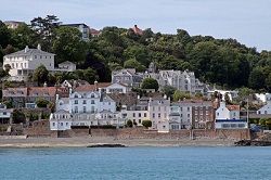
St Aubin is on the south coast looking over
St Aubin's Bay to St Helier. There is a long
Sandy Beach that connects St Aubin to St
Helier.
St Aubin's scenic Harbour has a large number
of small yachts and cruisers, and the Royal
Channel Islands Yacht Club is situated
here.
A short distance offshore, that can be
reached during some low tides, is St Aubin's
Fort, built in 1542. The Fort was built for
Henry VIII 1509 - 1547, for protection against
Sea Raiders.
|
|
Just north of St Aubin & St
Helier is Hamptonne, a Museum of
Country Life.
|
|
|
The Museum gives information on almost 300
years of Rural Heritage on the Island. The
Museum covers characters from the past, by-gone
skills, and a variety of farmyard animals. You
can aslo view the buildings, kitchen garden,
orchard, and meadows.
More
Information . Map
Also in this area is the the German
Underground Hospital, or Jersey War Tunnels
Museum. These are a partially completed
underground Hospital built by German forces
during their occupation of Jersey in the midst
World War II. Over 1,000 yards of Tunnels were
completed.
More Information . Map
|
|
There are a few boat trips you can
take from Jersey, such as the most
popular being the Jersey - Guernsey
Ferry that takes about 1 hour in the
Fast Craft, or 2 hours on a
Conventional Ferry.
|
|
|
Check prices at the website: condorferries.co.uk.
For information on all the destinations in
the Channel Islands, France, England and
Ireland that the ferries travel to, visit:
jersey.com
|
|
St Peter
Port is the Capital of Guernsey,
where the St Helier Ferries dock.
More
Information
|
|
|
Guernsey’s capital has been a busy
port since Roman times. The Harbour is deep and
well protected, so became the main port in the
Channel Islands for the various Countries that
controled the Islands over the centuries. The
Port also has a history of Ship Building,
Privateers, and Merchant Adventurers.
The Towns premeier buildings are mainly
Georgian and Regency styles, with some French
styles. Hotels .
Self Catering
. Restaurants
|
|
The most popular shopping goods available at
low prices are: electronics, photographic,
jewellery, perfume, wines, spirits, tobacco,
clothes, shoes, leather goods, antiques, and
the famous Guernsey jumper.
|
|
|

