 |
Mountains throughout the world |
RS Home |
|
Below is a list of Mountains throughout the World that attract many climbers from their region and around the world. The most climbed mountains are normally the highest mountains in that region, as most climbers want to conquer the highest peak in the region they are visiting. Mountains are normally listed by height above sea level, or, height above their base. Mount Everest on the China and Nepal border is the highest mountain above sea level, Mount McKinley in Alaska USA is the highest above its base. Everest at 29,000 feet sits on a plateau that is 15,000 feet above sea level, so from base to peak is about 14,000 feet. McKinley is 20,300 feet above sea level, 18,000 feet above its base. Both measurements are useful as height above base shows how far you have to climb, and how impressive the mountain looks before you climb. Height above sea level is extremely important when the mountain exceeds 8,000 feet as, altitude sickness can begin at this height. Bewteen 12,000 and 14,000 feet, altitude sickness becomes a real problem. From this height up, normally requires a day or two stop every now and again to aclimatise. Above 26,000 feet is regarded as the Death Zone. Oxygen in the death zone is about one third of that at sea level. Only top climbers can survive above 26,000 feet for a few days, all others have to carry bottled oxygen. Any injury or illness in the death zone makes rescue extremely difficult. Many people that take ill at that height have to be left to die, their bodies are then left where they died, or are buried in the snow or under rocks close to where they died. Everest has well over 100 bodies laying around above 26,000 feet. Climbing the highest mountain means passing numerous bodies along the route. One part of Mount Everest has been named Rainbow Valley, due to the number of corpses laying around that area with their different coloured climbing jackets. Most mountains of a few thousand feet have a number of areas that can be deadly. Mountains with tourist trails up to a 5,000 feet climb, 3 - 8 hours in time, can attract climbers with very little climbing experience, or none at all. Mist and cloud lead to some novice climbers, and intermediate climbers, straying off the main trails and falling over cliffs. The mountains listed below start in the UK where a mountain over 3,000 feet is regarded as high and a good challenge taken in one day. The list then shows European mountains that work up to 15,000 feet, then Africa, Americas, and finally the Asian mountains over 29,000 feet. Feet above base listed below may be from where the walking route starts from. |
|
Scafell Pike Map . Wasdale Inn . Video |
|
|

Carrauntoohil Video . Map/Reviews . Hotels |
|
|

Mount Snowdon There is a restaurant and shop at the top station,
60 feet below the summit. The main walking routes
take about 3 hours to the top, the railway and
tourist paths start from the town of Llanberis. |
|
|

Ben Nevis |
|
|

Kebnekaise Getting to the lodge is an adventure in itself, as you can hike the 12 miles, take a boat trip part of the way and hike the rest, or take a helicopter that operates all day in summer. The hike to the summit from the lodge takes 4 - 6 hours, can be dangerous in parts with ice. The closest town with a number of hotels is Kiruna 40 miles east of Nikkaluokta. For the larger Image view wiki |
|
|

Galdhopiggen Regular buses run from Oslo and other Norwegian towns to the tourist village of Lom and Juvasshytta Lodge, that are 20 miles apart. The area is a popular tourist destination, and there is a Ski Centre on the mountain. For the larger Image view: wiki |
|
|

Aneto For the climb, many people base at the closest
town of Benasque in the Hotel Aneto, they
then take a bus from Benasque into the Natural Park of
Posets-Maladeta to the area named La Besurta,
then walk about 30 minutes to the Refuge of La Renclusa
at 7,000ft. The climb to the summit begins at the
refuge and crosses a glacier on the way. Close to the
top is a narrow ridge named The Bridge of Mohamed,
with extremely high drops either side as can be seen
on the video. You can also stay at the refuge. |
|
|
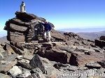
Mulhacen Most summit attempts depart Capileira and spend a
night at the mountain Refuge at Poqueira at
8,100ft, but some try it in one day. The mountain is
classed as dangerous with ice, snow, avalanches and
strong winds much of the year. Also, it can get
extremely warm in the height of summer. |
|
|
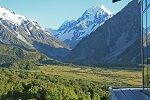
Mount Cook Most people climbing this mountain use a company
like Alpine Guides that take 6
days to prepare and climb the mountain. The climb is
about 5,500 feet, taking 15 - 18 hours. This can be
an extremely dangerous mountain with changing
conditions and strong winds. |
|
|

Mont Blanc From there, the climb begins and passes through the Gouter corridor then up to the Refuge on the mountain Dome du Gouterat 14,121ft, where you stay overnight. From the refuge, you make the final 1,600 ft climb to the summit of Mont Blanc. This is reported to be the deadliest mountain in the world, with about 60 deaths in one year alone. Many climbers visiting this region also want to
climb the fearsome looking 14,692ft Matterhorn and the 13,025 ft
Eiger with its deadly north
face, 6,000ft almost straight down. |
|
|

Mount Ararat The adventure starts from the Turkish town of
Dogubayazit at 5,300
feet above sea level. You take a truck from the town
to the bottom of the mountain at 6,500ft. The first
overnight camp is at 10,500ft. The next part of the
climb is to another camp at 14,000ft. The next day
you climb to the summit. The climb is fairly straight
forward with the main hazards being snow, ice,
exhaustion and altitude. Video . Map . Large Image |
|
|
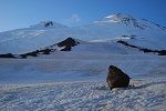
Mount Elbrus The first part of the climb is to Priut 11 at 13,600ft and
again spend time acclimatizing to the altitude. The
final climb to the summit from Priut 11 is about
5,000ft. The closest town to Azau Village, and
gateway to the region is Mineralnye Vody,
about 150 miles north. The climb is fairly straight
forward with the main hazards being the snow, ice,
exhaustion and altitude. |
|
|

Mount Kilimanjaro The most popular routes have huts at the end of
each stage. Other less popular routes mean sleeping
in tents. The way to the mountain is normaly fly to
Nairobi in Kenya,
then travel by road 128 miles south to one of the
villages at the base of the mountain. Some airlines
fly direct to the smaller Kilimanjaro Airport.
The climb is fairly straight forward with the main
hazards being exhaustion and altitude. |
|
|

Mount McKinley /
Denali The route to the mountain is fly to Anchorage, main town
in Alaska, then drive/bus 113 miles north to the
village of Talkeetna where you
take a ski plane up to base camp at 7,800 ft. Most
people climbing this mountain use guides as it is
extremely dangerous with 11 climbers dying in one
season alone. There is a high altitude helicopter
that can be used for rescue, when the weather is
suitable. Guides . Video . Map . Summit Images |
|
|
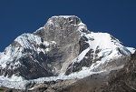
Huascaran This is a dangerous mountain with strong winds,
ice falls, and avalanche zones, so most people use
guides. The way to the mountain is fly to the city of
Lima, travel by bus 260
miles north to the city of Huaraz, then taxi 50 miles
north to the village of Musho. The most climbed mountains in Peru are the ones on
the Inca Trail over 10,000ft leading to the Inca town
of Machu Picchu located on a
ridge at about 7,700ft, a 7 day climb. Machu
Picchu is about 800 miles southeast of Huascaran. |
|
|

Aconcagua You need a permit and most climbers use guides.
There are two main routes that are described as
fairly straight forward with the main hazards being
ice and altitude. The Polish Traverse route takes
about 14 days, moving your gear up, plus resting and
getting used to the altitude. The first 6 days are
spent getting yourself and gear up to camp 1 at
16,200ft. By the 10th day, everything needed should
be at camp 2 at 19,200ft. After a rest and weather
permitting, on day 12 you go for the summit taking
between 10 and 12 hours for the round trip. Guides . Video . Large Image |
|
|
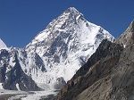
K2 There are a number of routes to the top with the most popular now becoming the Abruzzi Spur, taking about 70 days all in, costing about £31,000 for the package. The way to K2 is fly to Islamabad northeast Pakistan, make your way 207 miles northeast to the village of Askole at 9,100ft by jeep, then trek for about 14 days to base camp on the Godwin Austin glacier at 16,700ft. Between camp 2 and 3 is the most difficult part of the climb, consisting of about 1,300ft of near vertical climbing on mixed rock and ice. Top camp 4 is at about 26,000ft. The final 2,200ft push to the summit takes about 12 hours from camp 4 and is where most people die by falling or by ice falls. Large Image from: wiki |
|
|
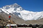
Everest The southeast base camp is at about 18,000ft, and top camp 4 at about 26,000ft. The final 3,000ft push for the summit normally starts about midnight, taking about 10 hours. Above Camp 4 at 26,000ft, you are in the Death Zone, where you can only survive for a day or two using up your bottled oxygen. You pass Greenboots Cave at 27,890ft where a dead Indian climber with green boots has lay since dying there in 1996. You then cross the knife edge ridge named Cornice Traverse with an 8,000ft fall on one side, and a 10,000ft fall on the other, climbers that fall to their death from here are said to have taken the Grand Tour. Just above the Cornice Traverse is the Hillary Step, a 40ft rock wall at 28,740ft. Just before the summit, you pass Rainbow Valley, so named as there are many bodies lying around with different coloured climbing jackets. There are well over 100 bodies laying around above 26,000ft, so the climb can be traumatic. Although there have been over 200 deaths on Everest, the percentage rate is only about 6%, low compared to other mountains close to this height with death rates over 20%. Over 3,600 people have now made the summit of Everest. The summit is so cold at times, severe frost bite often occurs leading to toes, fingers, feet or nose having to be amputated. It is just your luck how cold it is when you reach the summit, temperature at the top cannot be predicted. To get to the Everest Southeast Ridge route, make
your way by airlines to Katmandu capital of Nepal,
take a small plane to a scary airstrip at Lukla 73 miles east at 9,380ft, then trek
for about 10 days, 38 miles to Everest Base Camp at
18,192ft. Many people do the trek to base camp only,
just for the experience. Video . Map . Images Base Camp |
|
26,000 ft plus Mountain list with Death Tolls |
RS Home |
| - |