|
Bowness on Solway is a small Village
at the west end of Hadrian's Wall in
Cumbria, 15 miles west of Carlisle,
84 miles west of Newcastle.
Bowness on Solway is popular as the
start or the end of 84 mile long
Hadrian's Wall Path.
For Images on Mobile swipe right
|
Area Attractions Click on Map.
The Hadrian's Wall Path is normally split
into 5 sections, between 14 and 24 miles per
day. Bowness on Solway to Carlisle is the
first, or last section at about 15 miles. The
Path opened in 2003.
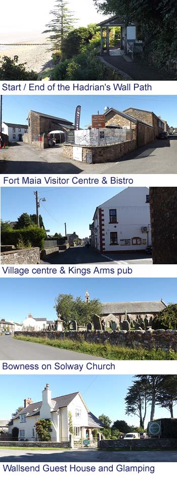
There is a Campsite in the Village also
with Wigwams and a Guest House, popular with
walkers as seen in the image bottom right.
The image top is of the start of the
Hadrian's Wall Path in the Village.
The Second image is of the Fort Maia
Visitor Centre with a Cafe and Bistro, across
the road from the Hadrian's Wall Path.
Fort Maia was the second largest Fort on
Hadrian's Wall at about 6 acres, built from the
year 120AD, little remains as the village was
built over it, and used the stone for the
buildings. The largest fort was at Carlisle
named Uxelodunum at about 10 acres.
The third image is of the Village centre
with the Kings Arms pub, diner
and B&B, built in 1720 as a Coaching
Inn.
The second bottom image is of St
Michael’s Church in the
Village, built from the 1100s with Stone from
Hadrian's Wall.
The Village of Bowness on Solway would have
evolved around fishing and farming up to the
Solway Junction Railway was built through the
Village in 1869, connecting Cumbria to
southwest Scotland.
A huge Viaduct was built across the Solway
Firth from Bowness on Solway to Annan in
Scotland for the Railway, just over 1 mile
long, demolished in 1934 due to high
maintenance costs.
This Railway was built to transport high
grade Iron Ore from Cumberland in England to
the Iron Works in Ayrshire and Lanarkshire in
Scotland.
wiki/Solway_Junction_Railway
Bowness on Solway is now a quiet farming
village, Nature Reserve, and tourist
attraction, including angling on the Solway for
bass, cod, flounder, plaice, sea trout, and
thornback ray.
|