|
Where: Catbells hike from Keswick in the
Lake District of England
When: April 2016
Weather: Sunny
Height: 1,480ft 451m to 2,470ft
The Catbells hike is one of the most
popular hiking routes in the Lake District of
England. Catbells itself is 1,480ft, and the
mountains to the south, on the same range,
are the 1,890ft Maiden Moor, 2,080ft High
Spy, and 2,470ft Dale Head, so a number of
options to suit most hikers, and they have
great views over Derwent Water to
Keswick.
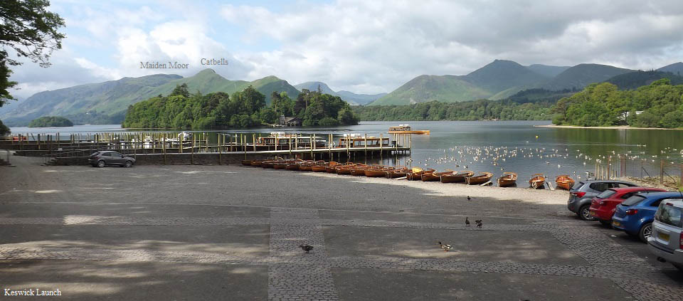
The main car park for Catbells only holds
about 12 cars, and a couple of roadside
parking places only hold about 6 more, so
many hikers are advised to take the boats
from Keswick Launch, as seen below.
These boats run regular throughout the
year, straight across to Nichol End at the
village of Portinscale, then down to Hawes
End for the Catbells hike.
There is also a hiking bus that runs round
to Catbells from Keswick, from spring to
autumn. Keswick to Catbells Road Map
.
There is also a walking route round from
Keswick that takes about one hour round the
north end of the lake. Keswick Page.
Large Image .
Keswick Launch
Web
|
|
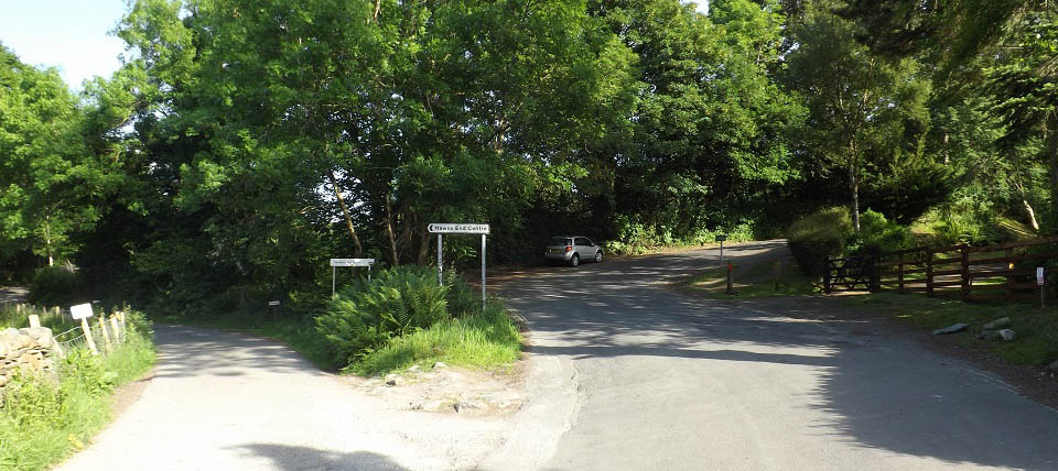
The image below is of the Hawes End road
down to the left, close to Catbells. That is
the road you come up if you travel by boat.
Catbells is about 300 yards up the main road
here, to the right.
I you drive round from Keswick, go through
Portinscale village, departing from the south
of the village, following the main road and
veering to the left at a junction just south
of Portinscale, that brings you to this point
at Hawes End.
There are about 4 parking spaces on the
left there, you are not supposed to park on
the right, as there is a sign warning against
parking there. Buses and deliver trucks have
to use this narrow road and need places to
pass.
|
|
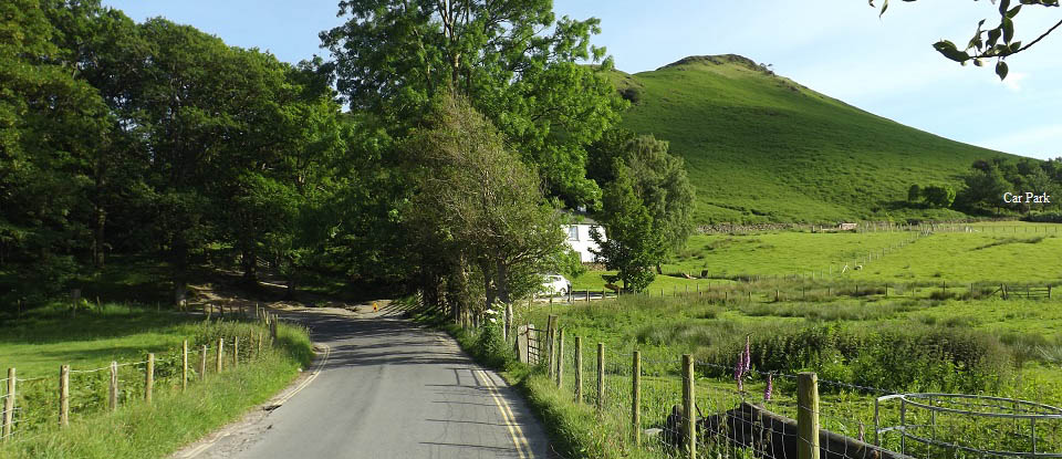
The image below is just up from the Hawes
End road, looking at the north side of
Catbells mountain. There is space for another
two or three cars to park under the trees
there, as long as you do not block the
entrance to the house.
The main car park is next to the road up
behind the house. That car park holds about
12 cars, not nearly enough for such a popular
hike.
|
|
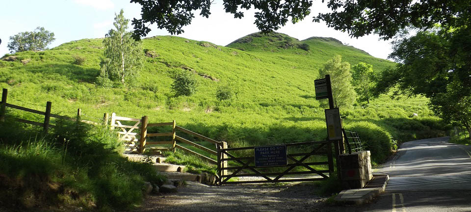
The image below is from just up behind the
house as seen above, at the Catbells bus
stop, and start of the main trail onto the
mountains.
The road round to the left is the one the
bus uses. It runs down the east side of the
mountains by the Lake. The road to the right
leads to the main car park.
|
|
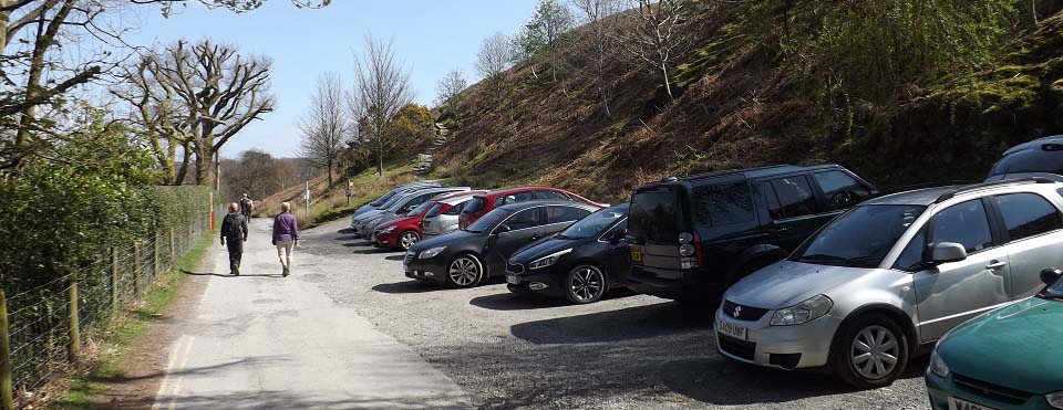
The image below is of Catbells Car Park.
This is all the cars it holds. This road ends
at the car park, is private from the park on
to a farm.
That is the trail at the car park leading
up to the north side path. The images from
here were taken in April 2016.
|
|
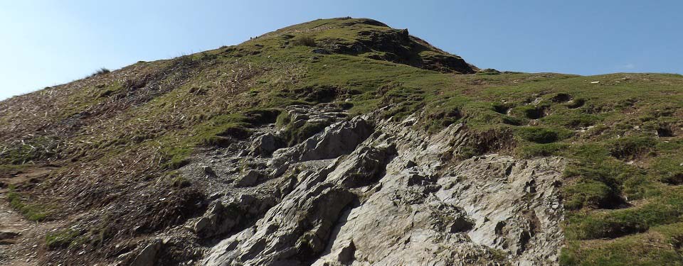
The image below is of the north side trail
up Catbells, the most popular route. The car
park and bus stop trails merge about
here.
|
|
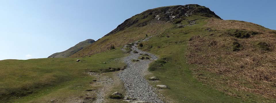
The image below is of the first summit of
Catbells, with the higher peak in the
distance.
|
|
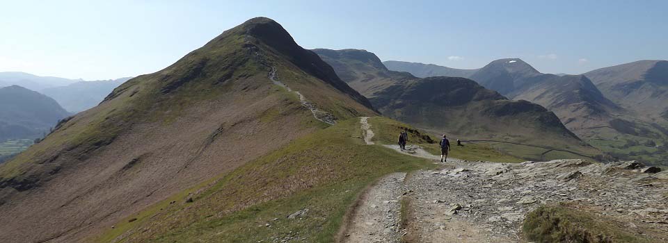
The image below is from the first peak
looking south to the main summit of Catbells
fell / mountain or hill.
There is a little bit of scrambling up
through the rocks on this section.
|
|
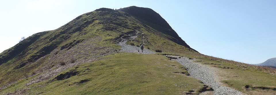
The image below is towards Catbells
summit. At 1,480ft, Catbells is more
adventurous than many mountains over
3,000ft.
|
|
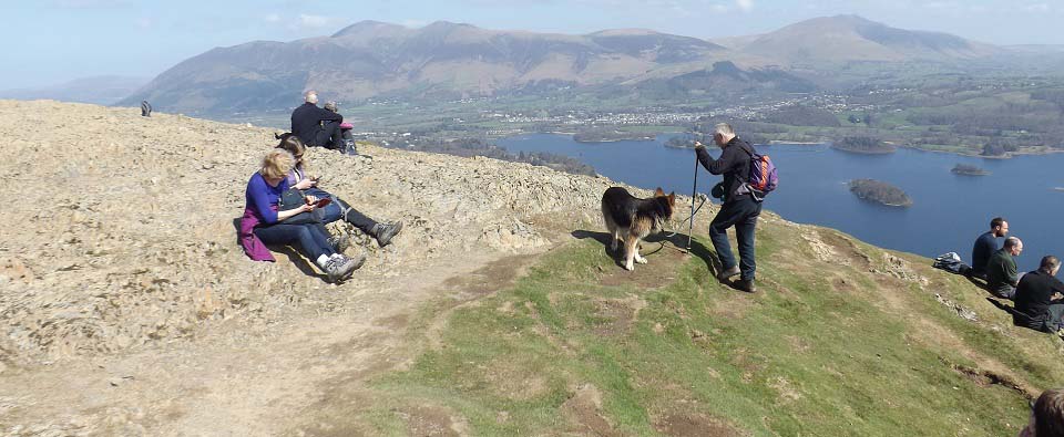
The image below is from Catbells Summit
looking northeast across Derwent Water to
Keswick, one of the top viewing areas in
England.
|
|
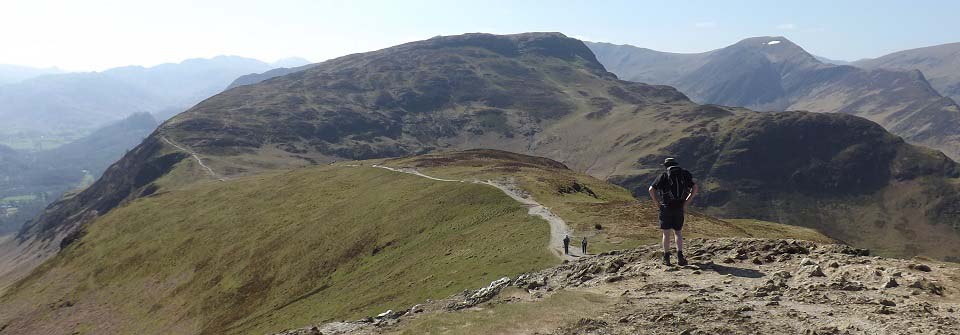
The image below is from Catbells looking
south to the 1,890ft Maiden Moor, with the
2,080ft High Spy, and 2,470ft Dale Head
further on.
This was as far as I went, will return
some day to hike the whole range, will
probably be a fairly long day.
|
|
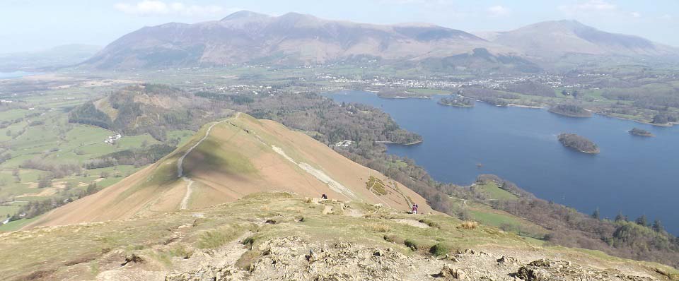
The image below is from Catbells summit
looking north at the route back down. That is
the 3,054ft Skiddaw in the distance, and the
2,848ft Blencathra over to the right.
|
|
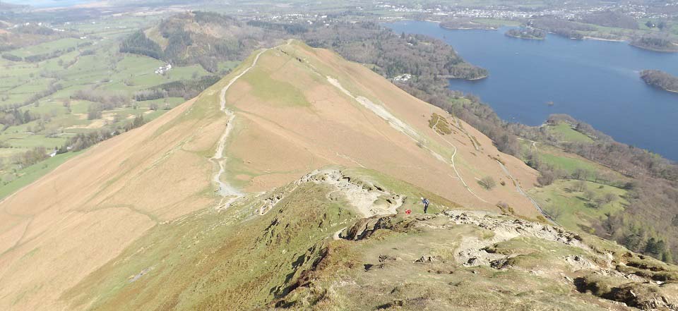
The image below is looking down the
steepest section. You can see a few faint
trails leading down both sides, the one to
the left leads to the car park, and one to
the right down to the lakeside road.
I noticed a number of cars parked
alongside the road down on the right. If
parking there, need to be careful to leave
passing places for cars and buses.
|
|
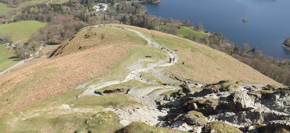
The image below is looking down the lowest
section with the car park down on the bottom
left. This image shows just how steep this
section is as well.
|
|
Make sure and take an Ordnance Survey Map
and Compass on these hikes, and know how to
use them, as in cloud, these mountains can be
deadly. In Winter, make sure you have
Crampons and an Ice Axe, and know how to use
them.
|
|