|
Where: Fairfield Hike from Ambleside in
the Lake District of England
When: July 2014
Weather: Sunny
Height: 2,864ft / 873m
Fairfield is the highest mountain for
hiking by the town of Ambleside in the Lake
District of England.
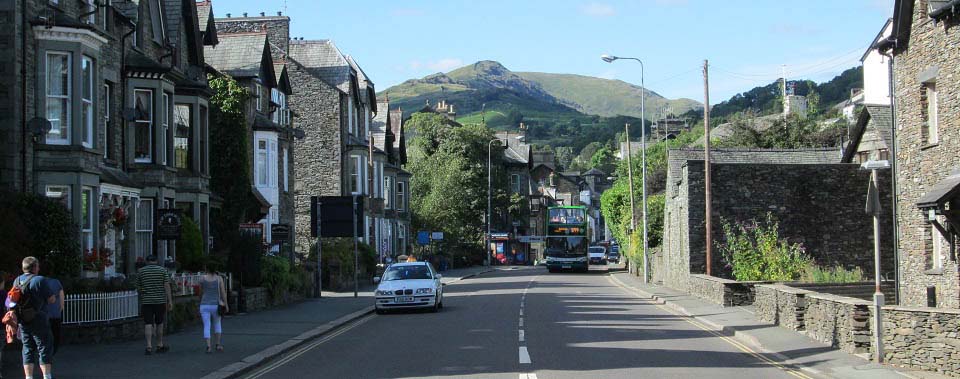
The image below is from Lake Road in the
centre of Ambleside, looking north to the
mountains, with Low Pike and High Pike the
first two peaks you have to go over to get to
Fairfield.
You can return back down the other range
in a horseshoe, round to the left in the
image below, to the small village of Rydal,
about 1 mile north of Ambleside. There is a
good path through Rydal Estate to
Ambleside.
This is a fairly long hike going over 9
hills/mountains.
Ambleside Road
Map
Fairfield Horseshoe
Large Image
|
|
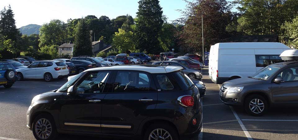
The image below is from the large car park
on the north side of Ambleside. You can just
see High Pike through the trees, and Nab Scar
over to the left.
This is a pay and display car park, do not
know of any free car parking in or around
Ambleside.
Leave this car park to the east, right in
the image below, via a footbridge over a burn
towards the main road.
|
|
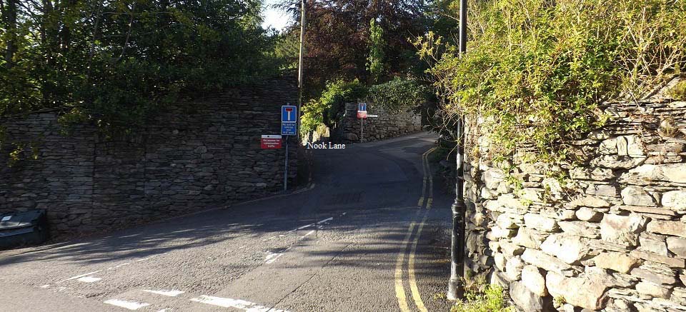
The image below is of across the road from
the car park looking up Smithy Brow. That is
Nook Lane, the first narrow road on the left
here.
The sign for Nook Lane is about 20 yards
up that road, so easy to miss.
Nook Lane runs for about 1 mile, up past
the University of Cumbria, and on to a small
farm named Nook End Farm. Walk through the
farm to two gates, then follow the trail down
and round to the left over a small bridge.
The hill trail starts from the small
bridge.
|
|
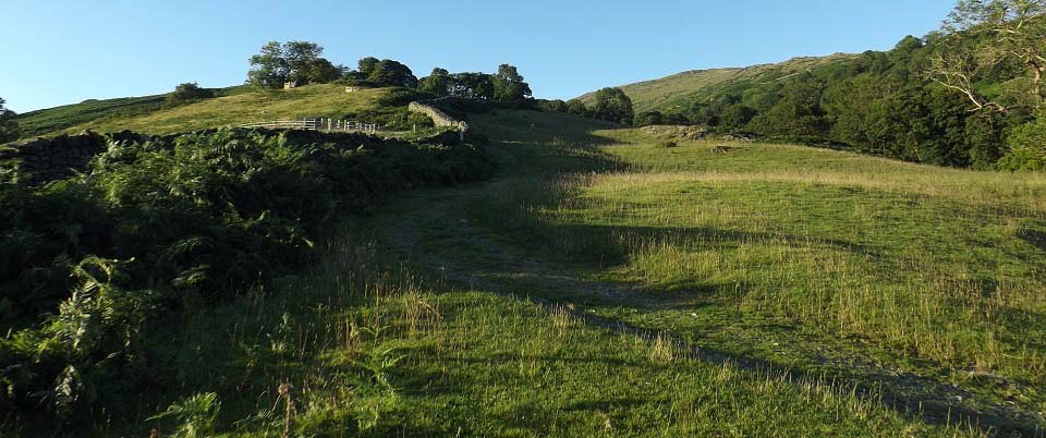
The image below is of the trail just above
the bridge. There are waterfalls by the
bridge, but hard to see for the trees in
summer, even the bridge is hard to see.
This is a cart track for a good distance,
going up at a steady incline.
|
|
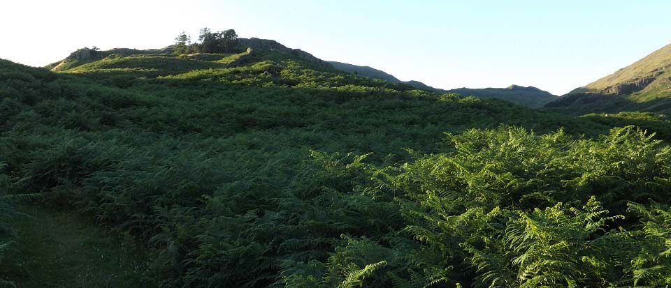
The image below is from where the trail
leads up towards the rocks of Low Pike.
The main trail follows a stone dyke from
here all the way to the top of the range.
|
|
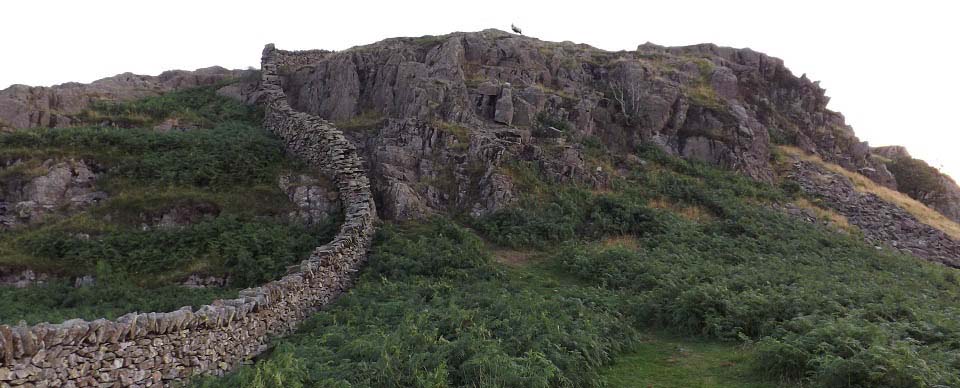
The image below is of the small cliffs
that have to be climbed to get to the top of
Low Pike at 1,572ft.
These are fairly easy to scale. Don't
think there is any easy way around them.
|
|
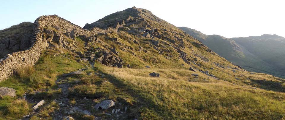
The image below is of the trail following
the stone dyke up to High Pike at 2,152ft.
There is a gate through to the other side of
the dyke, but best stay on this side as the
views are better from this side.
There is a wet section in this area with
warnings of deep bogs, but in this warm
spell, there was no problem.
Large Image
of this Great Wall of Amblside.
|
|
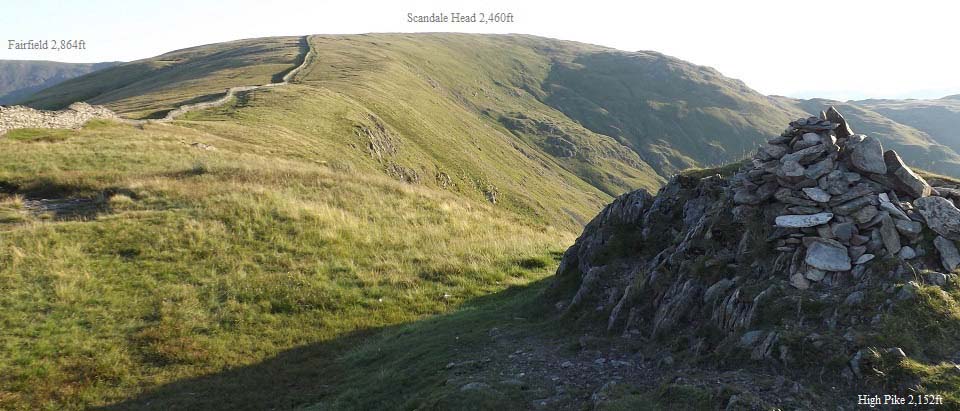
The image below is from High Pike looking
north to Scandale Head, and Fairfield over to
the left.
This image looks like the trail round to
Fairfield will be nice and level, so much for
looks.
|
|
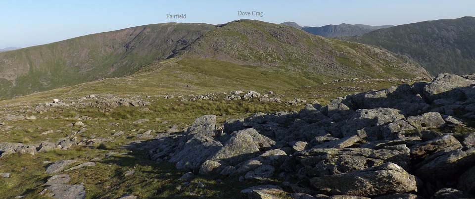
The image below is from Scandale Head
looking northwest to Dove Crag and
Fairfield.
Never saw this dip on the road up, and
there is a nice boulder field to go up
through.
|
|
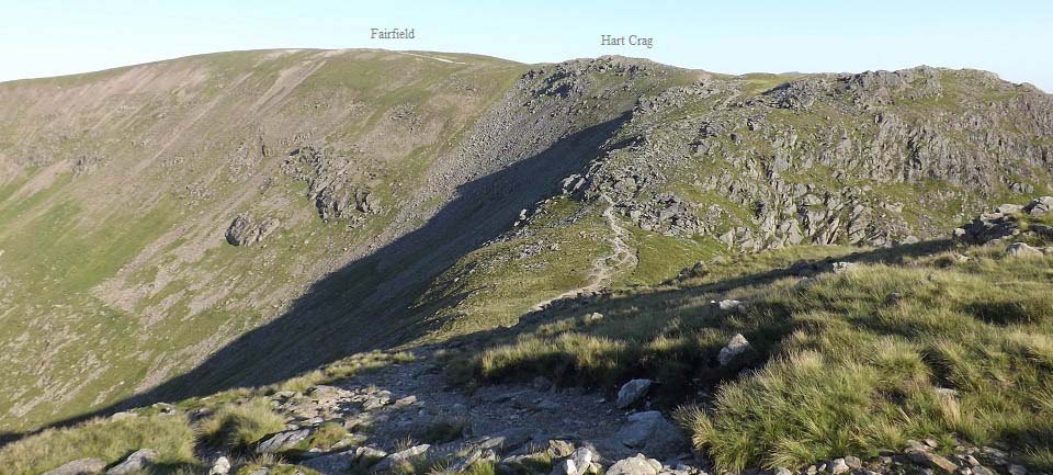
The image below is of the trail from Dove
Crag looking northwest to Hart Crag and
Fairfield. This dip is about 300ft, and there
is another boulder field to go up through, so
much for the level route round the top of the
horseshoe.
|
|
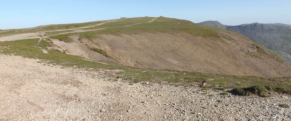
The image below is of the summit of
Fairfield Mountain. This is the highest point
on this horseshoe ridge containing 9
peaks.
That is the 3,117ft Helvellyn in the
distance. There is a high dip and two other
mountains to cross if you try to go there.
Large Image
out to Helvellyn from the North Side.
To the right in the image below is the
2,759ft St Sunday Crag mountain that leads
down into Patterdale. You have to cross the
steep Cofa Pike to get onto that mountain
though.
Large Image of Cofa
Pike
I met two hikers that were hiking from
Ambleside to Fairfield, then over Cofa Pike
and down into Patterdale. They were going to
get a bus back to Ambleside from Patterdale.
They said once they saw Cofa Pike on a
previous hike, they just had to return to
cross Cofa Pike and St Sunday Crag.
|
|
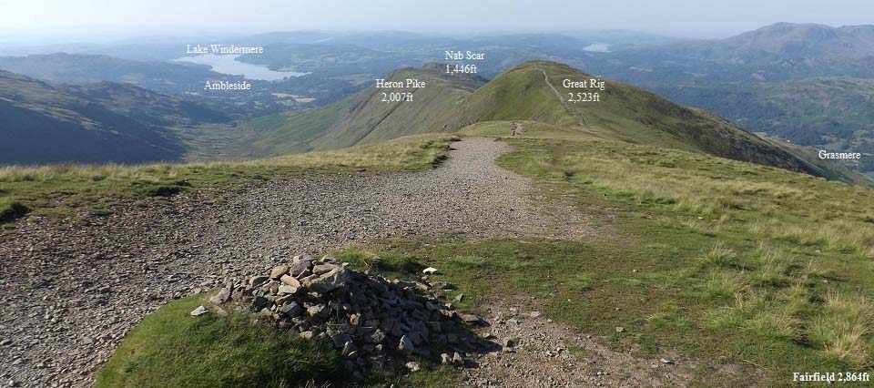
The image below is of the west ridge route
back to Ambleside. This is a fairly steady
route back down, but a lot longer than it
looks.
The two hikers heading over Cofa Pike,
stated they had hiked up both routes, and
much preferred going up the High Pike route
than this route.
You get great views down over the village
of Grasmere from this ridge.
|
|
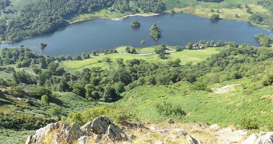
The image below is from the west side of
Nab Scar looking down over Rydal Water.
Large
Image
|
|
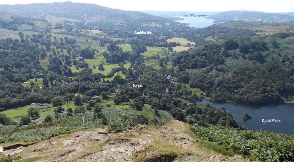
The image below is from the south side of
Nab Scar, looking down the steep winding
trail to the village of Rydal. There is the
Rydal Lodge
Hotel at Rydal, a large mansion named
Rydal Hall, Rydal Mount that was
a home of William Wordsworth, and the
Glen Rothay
Hotel with Badger Bar, all worth
visiting.
There is a well marked walking path back
to Ambleside that goes through Rydal Estate,
so no need to walk along the busy main road.
There are also regular buses from a bus stop
at the hotel to Ambleside.
|
|
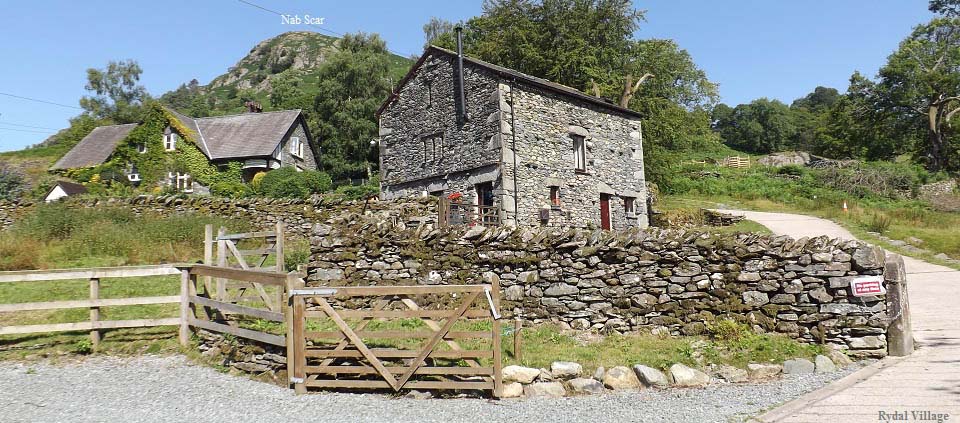
The image below is from Rydal looking back
to Nab Scar. If you are hiking up this ridge,
this is the route onto the range. The hike up
Nab Scar is really steep.
There is little parking in Rydal, with
what parking there is, mainly for the tourist
attractions in the village.
|
|
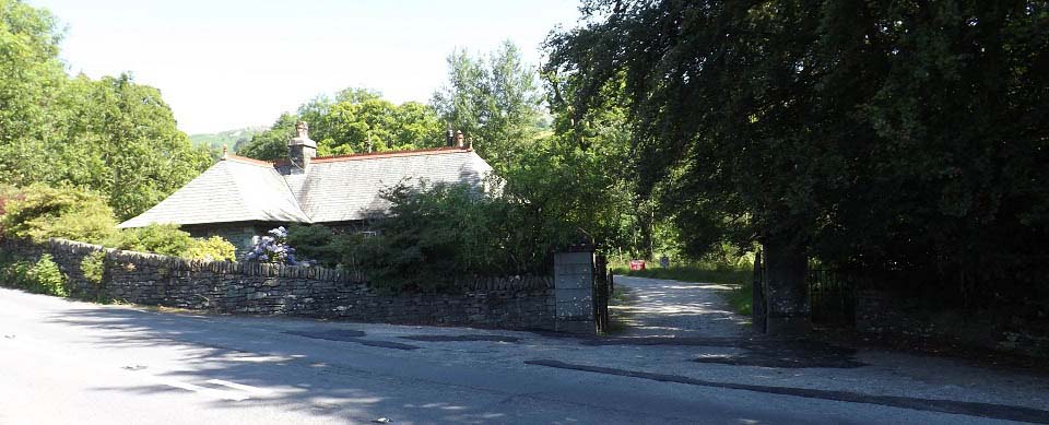
The image below is of the entrance to
Rydal Estate, by the speed signs at the north
side of Ambleside next to the A591 road. If
you are hiking up the Nab Scar route, this is
the footpath from Ambleside to Rydal. It is
about 1 mile from here to Rydal.
There is no sign at this entrance, so easy
to miss. Best to take this path as the path
alongside the main road, does not run all the
way to Rydal, so there is a dangerous section
where you have to walk on the busy road.
|
|
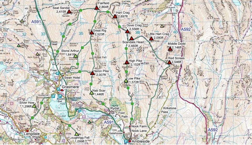
The Fairfield Map below shows the main
routes onto the mountains from Ambleside and
Rydal.
This is a fairly long hike over 9 peaks,
so be prepared for a long day.
Make sure and take an Ordnance Survey Map
and Compass on these hikes, and know how to
use them, as in cloud, these mountains can be
deadly. In Winter, make sure you have
Crampons and an Ice Axe, and know how to use
them.
Fairfield Hike Photo
Tour from Grasmere .
|
|
